
Association for Integrated Rural Development
A Non-profit, voluntary development organisation
A Non-profit, voluntary development organisation
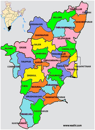
Tamil Nadu is the eleventh largest state in India by area and the sixth most populous state in India.
| Administrative division of Tamilnadu | |
|---|---|
| Districts | 32 |
| Revenue Divisions | 78 |
| Taluks | 248 |
| Revenue Villages | 17,244 |
| Municipal Corporations | 10 |
| Municipalities | 152 |
| Panchayat Unions (Blocks) | 385 |
| Town Panchayats | 562 |
| Village Panchayats | 12,618 |
As per the 2011 India census, Tamil Nadu had a population of 72,147,030. The sex ratio of the state is 995 female per 1000 male with 36,137,975 males and 36,009,055 females. There are a total of 23,166,721 households.
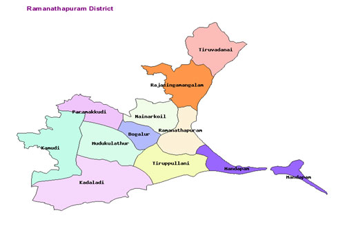
The total population of children under the age of 6 is 7,423,832. A total of 14,438,445 people constituting 20.01 per cent of the total population belonged to Scheduled Castes (SC) and 794,697 people constituting 1.10 per cent of the population belonged to Scheduled tribes (ST). Ramanathapuram District is an administrative district of Tamil Nadu state in southern India. The city of Ramanathapuram is the district headquarters. Ramanthapuram District has an area of 4123 sq km. It is bound by Sivaganga District in the North, Northeast by Pudukkottai District in the Northeast, by the Palk Strait on the East, by the Gulf of Mannar on the South, by Thoothukudi District on the West, and by Virudhunagar District on the Northwest. The district is divided into seven revenue divisions with Ramanathapuram town as its headquarters. It has two municipalities, one township and nine panchayats. Rural Development Programmes of the government are implemented through 11 administrative blocks (Panchayat unions) and 429 village administrative bodies (Panchayats) with 2362 hamlets. Rameswaram a coastal town is a legendary pilgrim center for Hindus. "The waterless forest" as widely known Ramanathapuram district lies in the southeast coastal district of Tamilnadu, India. This goes to say that the district is drought prone for the greatest part of the year. Nature of the land is mostly flat and sandy. Due to lack of irrigation, agriculture depends only on rain water, which is very low and scarce. The three major reservoirs too suffer scarcity of water almost throughout the year. Palmyrah trees which thrive in this climatic condition are the only species found abundantly in this district. Recent days “Karu Odoi/Karu Vela maram” tree variety (Prosopis juliflora) brought to meet the fuel need of the rural people is encroaching most of the areas and adding up to the worst condition still further.
According to 2011 census, Ramanathapuram district had a population of 1,353,445 with a sex-ratio of 983 females for every 1,000 males, above the national average of 929. Scheduled Castes and Scheduled Tribes accounted for 18.4% and .08% of the population respectively. The district had a total of 323,905 households. There were a total of 602,977 workers, comprising 149,959 cultivators, 103,592 main agricultural labourers, 18,546 in house hold industries, 214,053 other workers, 116,827 marginal workers, 23,808 marginal cultivators, 50,282 marginal agricultural labourers, 6,682 marginal workers in household industries and 36,055 other marginal workers. The main occupations are Fishing, Agriculture, Palmyrah Tapping, Petty trades and businesses. The traditional land tenure system in the villages has left large number of people to remain marginal and landless laborers. About 80% of the land holding is with 5% of the rich in rural areas. Besides, this district does not have any job-oriented industries. Employment opportunity, on the whole, is very low causing income insecurity. This tends migration of the people to other parts of the country as well as abroad that adds up to other health related issues like HIV/AIDS.